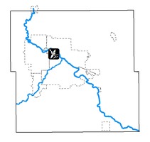
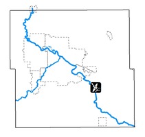
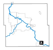
- Washington Union
- Black Hawk Park
- Sherwood Park
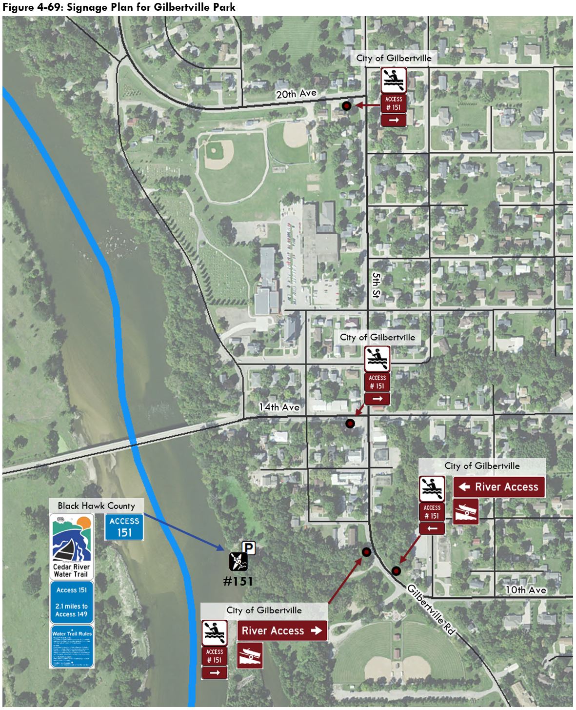
- Gilbertville Park
- Cedar River Natural Resource Area
- Cedar River Access
- McFarlane Park
Washington Union

Jurisdiction: Black Hawk County
Access number: 179
Launch type: Boat ramp
Next segment skill level: Beginner
Next segment classification: Recreational
Distance to next access: 4.1 miles

Washington Union is located at the confluence of the Cedar River and the West Fork Cedar River. This access is among the most popular in the county for motorized boaters and paddlers alike. Currently, the gravel driveway to the access area is very steep and in poor condition. The parking area itself is undefined, and vehicles can get boxed in on busy weekends.
The County Engineering Department will be replacing the Cedar Wapsi Road Bridge over the Cedar River in 2019 and 2020. The alignment of the new bridge will be further south than the existing bridge. As part of this project, the driveway to the access area will be rebuilt and the parking will be expanded. A new walking trail will also be constructed from the parking area to the public land southwest of the new bridge. Across the road, the driveway to these public lands will be removed, as the expanded parking at the Washington Union access will serve that area.

While the bridge reconstruction project will expand the Washington Union parking area, several additional improvements have been identified as part of the Water Trails Master Plan. These recommendations are described on the following pages.

Public Comments
Two written comments were received regarding Washington Union:
- “Because it’s such a popular take out/put in, Washington Union access really could be expanded, even add a ramp on the southeast side of the bridge.” – Cedar Falls resident
- “Washington Union access has horrible access due to steep drive and can’t see traffic coming. Accident waiting to happen. Plus not enough parking. Check it out on weekends.” – Black Hawk County resident
In addition, four respondents indicated they would like a restroom, two indicated they would like drinking water, and one indicated there are maintenance issues at Washington Union.
Site Recommendations

The recommendations for Washington Union will enhance the newly expanded parking area. As part of the County’s bridge replacement project in 2019 and 2020, the new parking area will be surfaced with gravel and additional rock will be used to blend and match the existing parking lot surface. Most of the existing parking area will not be resurfaced as part of the County project. Costs shown in Figure 4-12 reflect the cost of completely reconstructing the entire parking area. The actual costs for the parking lot improvements will likely be much lower as long as the new surface remains in good condition.
Future parking improvements include reshaping the parking area to allow for nine (9) spaces suitable for pull-through trailer parking and eight (8) standard sized parking stalls. One of the planned pull-through stalls is accessible with an adjacent 10’ x 10’ staging area. A 4,000 square foot filter strip is also planned in order to treat runoff from the parking lot and restore the riparian area.
The planned parking improvements include two vegetated parking islands with pollinator plantings. These function to improve traffic flow, and one of the planned islands will be situated as to preserve the landmark oak tree currently in the parking area.

The existing boat ramp works well and can be reinforced with new class B revetment rock. The site plan also includes a tie-down lane for motorized boats and a staging area for paddlers to load and unload their gear. At night, the entire area can be illuminated by a solar-powered flood light which should be able to stay on for 6 to 12 hours after dusk.
Cost Estimate

Signage
Currently there are two County Arrowhead signs on West Cedar Wapsi Road pointing to the Washington Union boat ramp. These signs will be replaced upon completion of the new bridge in 2020. Water trails signs can be included as part of the bridge construction project. The sign immediately east of the access should be installed on the bridge or very closely to avoid confusion with the private driveway immediately northeast of the bridge.

Black Hawk Park

Jurisdiction: Black Hawk County
Access number: 175
Launch type: Boat ramp
Next segment skill level: Beginner
Next segment classification: Recreational
Distance to next access: 3.6 miles

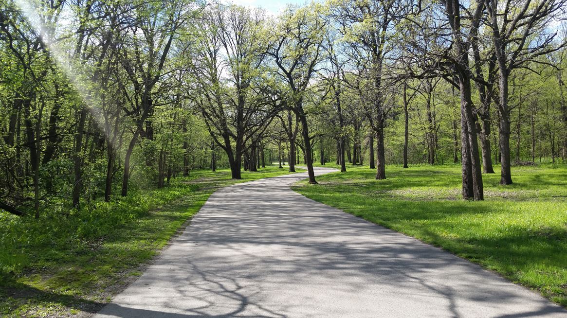
Black Hawk Park is a popular river access for motorized boaters and paddlers alike. The park also features the northernmost public campground in the County, and it is the northernmost park situated on the paved recreational trails network (see Figure 1-13).
The boat ramp area is currently set up for one-way traffic which can lead to confusion. Vehicles headed in the wrong direction can meet other vehicles head-to-head, resulting in delays and awkward turning movements. Improvements to the parking area should include provisions to improve the parking lot traffic flow.
Public Comments
Four written comments were received regarding Black Hawk Park:
- “Black Hawk Park boat ramp could use some maintenance” – Cedar Falls resident
- “Black Hawk Park boat ramp isn’t great” – Cedar Falls resident
- “Black Hawk boat ramp could use improvements” – Cedar Falls resident
- “Black Hawk Park ramp is unsafe” – Cedar Falls resident
In addition, three respondents indicated they would like a restroom, and one indicated they would like drinking water near the Black Hawk Park boat ramp.
Site Recommendations

Planned improvements to the Black Hawk Park access area include two vegetated parking islands with pollinator plantings to improve traffic flow. The expanded parking area can allow for up to 17 stalls for pull-through trailer parking, including one accessible stall with an adjacent 10’ x 10’ staging area. A 4,400 square foot filter strip is also planned in order to treat runoff from the parking lot and restore the riparian area.
Black Hawk Park would also benefit from shoreline improvements which are not included in the project cost estimate. Shoreline improvements could take on many forms, and it is up to the County Conservation Board to determine the most appropriate treatment for this site. Currently, broken concrete and fallen branches line the shoreline along Black Hawk Park. While these materials function as an affordable method of armoring the streambank, enhancements to beautify this shoreline should also be considered.

Cost Estimate

Signage
Currently there are three County Arrowhead signs for Black Hawk Park at the intersection of Center Street and West Lone Tree Road. Water trails signs can be added alongside each Arrowhead sign to indicate the river access is present and emphasize the turning movement.

Wayfinding signs currently exist within Black Hawk Park to direct visitors to the various park amenities. Additional wayfinding signage within the park is unnecessary. However, a left-turn sign assembly at the boat ramp is recommended, as there is no “Boat Ramp” sign at the ramp itself .

Sherwood Park

Jurisdiction: Black Hawk County (ramp and parking), City of Waterloo (grounds)
Access number: None (possibly define as 167)
Launch type: Boat ramp
Next segment skill level: Beginner
Next segment classification: Gateway
Distance to next access: 1.8 miles
Sherwood Park is located within the city limits of Waterloo and is easily accessible off the U.S. Highway 218 exit at Greenhill Road. The park itself is relatively new, and the City received a REAP grant from the Iowa DNR in 2014 for its construction. The boat ramp area is upstream from Sherwood Park, approximately 1,000 feet past the park entrance. While the City manages the park itself, the County Conservation Board maintains the boat ramp and the river access parking area.
The existing parking area at the river access is actually two separate parking areas connected by a short dirt drive. River users may find the parking areas uncomfortable after dark due to their isolated location. Installation of lighting fixtures would help address this. The two parking areas could be combined, which presents an opportunity to redefine the space and improve the flow for vehicle traffic.

Public Comments
Four written comments and one verbal comment were received regarding Sherwood Park:
- “Add 10 or 15 feet of concrete to the Sherwood park boat ramp.” – Waterloo resident
- “Patrol the ramp by Greenhill Rd.” – Waterloo resident
- “Putting in a dock at Sherwood would be helpful.” – Waterloo resident
- “Consider putting money into Cedar Bend boat launch or Sherwood Park boat launch – docks to get people on and off boats.” – Waterloo resident
- I would like to see boat docks between Waterloo and Cedar Falls such as at Sherwood Park to allow for pontoon boat docking. It would be nice to have more than one dock. Currently there’s only one at the Boathouse. This would make it possible for one person to get to their vehicle. – Waterloo resident, by phone
In addition, one respondent indicated they would like restrooms and drinking water at Sherwood Park.
Site Recommendations

Recommendations for the Sherwood Park river access area include notable changes to the existing parking areas. The recommendations include combining the two parking areas into one, and using parking islands to define the new spaces. Removal of five trees and some understory vegetation will be required to accomplish this. The planned parking area includes seven parking stalls for pull-through trailer parking, including one accessible stall with an adjacent 10’ x 10’ staging area. Two tie-down lanes are also planned for motorized boaters. The existing wooden bollards which define the existing driveway can remain as-is.
In addition to the recommendations shown above, multiple survey respondents suggested adding a boat dock at Sherwood Park. The location of Sherwood Park is ideal for a new dock, as it is roughly equidistant between downtown Cedar Falls and downtown Waterloo. Because of the variety of possible designs and engineering considerations involved with installing a dock, an estimated cost is not included in this document. However, the Water Trails Master Plan supports the construction of a boat dock at this site. A new dock would serve residents of Waterloo and Cedar Falls living near Rainbow Drive, Greenhill Road, and University Avenue.
Cost Estimate

Signage

Gilbertville Park

Jurisdiction: Black Hawk County (ramp and parking), City of Gilbertville (grounds)
Access number: 151
Launch type: Boat ramp
Next segment skill level: Beginner
Next segment classification: Recreational
Distance to next access: 2.1 miles
Gilbertville Park is a river access area in the southwest end of the City of Gilbertville. The boat ramp and parking area are managed by the Black Hawk County Conservation board, and the grounds are managed by the City. The river access is adjacent to a residential neighborhood to the north and more public lands to the south. A small pedestrian bridge connects the river access to the public lands to the south, which include a shelter, basketball court, ball diamonds, a yard waste dropoff site, and the Veterans Park memorial area and splash pad.
Despite being situated next to a residential neighborhood, the river access sits at a much lower elevation which makes construction of a pedestrian trail to the neighborhood cost-prohbitive. The only way to reach the river access area and adjacent public lands is from Gilbertville Road. Gilbertville Road has no sidewalks, and it is curved which reduces visibility for automobile traffic. The river access is easy to miss for drivers unfamiliar with the area. Signage to the river access would be greatly beneficial for boaters and other water trail users.

Public Comments
One written comment was received regarding Gilbertville Park:
- “[Add] kayak docks, signage. Especially in Gilbertville. The area is hidden and hard to find.” – Evansdale resident
In addition, three respondents indicated they would like fresh water, and two indicated they would like restrooms at Gilbertville Park.
Site Recommendations

Recommendations for Gilbertville Park involve a dramatic reconfiguration of the existing gravel parking area. This includes the installation of a new ramp for paddlers north of the existing boat ramp to separate paddlers and motorized boat traffic. Three parking islands containing pollinator plantings and a bike rack are also recommended. Existing trees should be preserved to help define the southernmost parking island.
This space allows for the installation of a 10,000 square foot filter strip between the parking area and the river. Wooden bollards or rock barriers can be added around the parking area to limit the impact of motorized vehicles and to allow for drainage within the park. A tie-down lane for motorized boats, a staging area for paddlers, and a staging area for an accessible parking space are also recommended.
Cost Estimate

Signage
Cedar River Natural Resource Area

Jurisdiction: Black Hawk County
Access number: 149
Launch type: Boat ramp
Next segment skill level: Beginner
Next segment classification: Recreational
Distance to next access: 7.0 miles
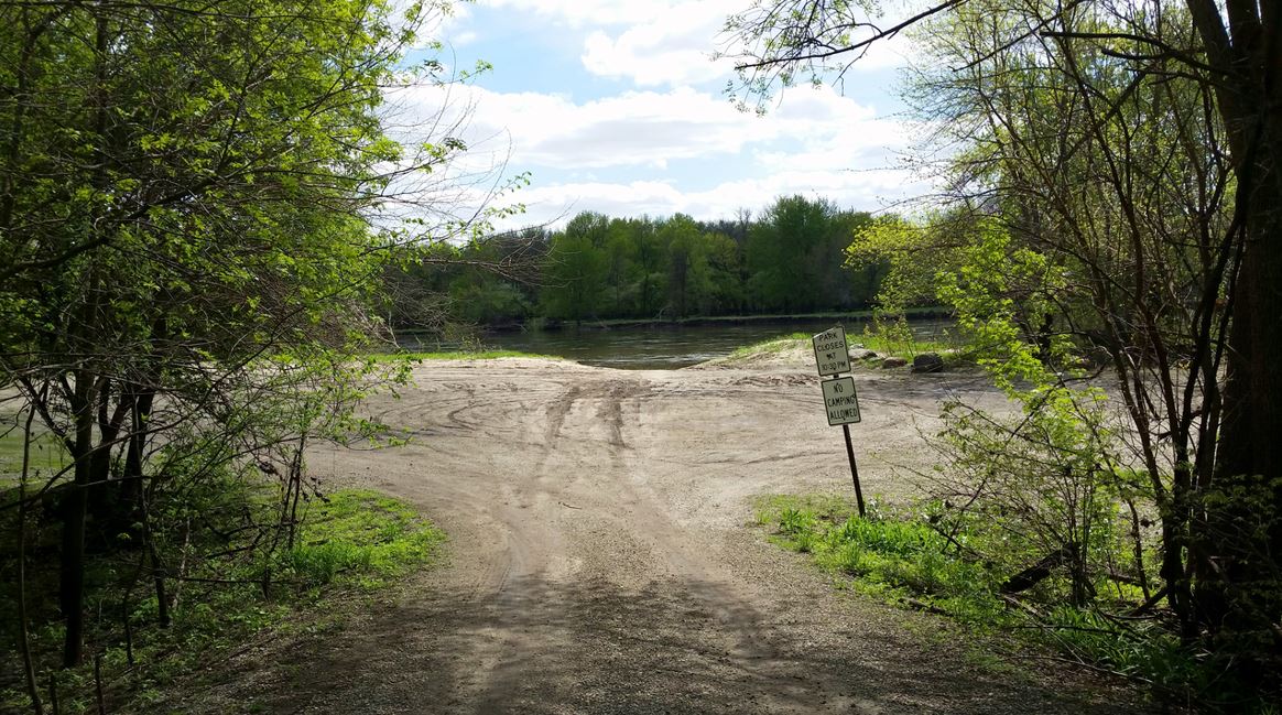
The Cedar River Natural Resource Area is situated along Miller Creek to the southeast of the metropolitan area. Miller Creek Road is the only roadway through the park extending over a mile from Girsch Road to the river access. The road is prone to flooding, and the river access is completely underwater during flood events. The river access parking area can become rutted, and the usability of the boat ramp largely depends on the water level.
Two shooting ranges are situated along Miller Creek Road on the way to the river access. Some water trail users unfamiliar with the area may find the shooting ranges alarming. Signage is in place near the western shooting range to inform travelers of the eastern shooting range. However, there is no signage to indicate there is a boat ramp present. There are signs to the park at U.S. Highway 218 and McKevette Road that include boat ramp symbols. However, additional wayfinding from Highway 218 to the boat ramp would greatly improve navigation to the river access.
There were no comments regarding the Cedar River Natural Resource Area.

Site Recommendations

The primary recommendation for the river access at the Cedar River Natural Resource Area is reconfiguring the parking lot and expanding it to improve traffic flow and access to the boat ramp. Wooden bollard or rock barriers are recommended around the perimeter of the parking area along with two parking islands to define the parking spaces. Pollinator plantings, one staging area, and a bike rack are also recommended at this location. A tie-down lane can also be created alongside the main driveway.
Cost Estimate

Signage

Cedar River Access
Jurisdiction: Black Hawk County
Access number: 141A
Launch type: Boat ramp
Next segment skill level: Beginner
Next segment classification: Recreational
Distance to next access: 0.3 miles
Cedar River Access is a standalone access area along the river’s northern shoreline. During high water events, the parking area and boat ramp are completely underwater. However, when the river level is low, this is a popular river access for boaters. For paddlers, this access can serve as a take-out for those beginning their trip upriver or as a put-in for those paddling into Benton County. Unlike other river accesses south of the metropolitan area, there is no bike trail near Cedar River Access.
The parking area can become rutted with tire tracks after rain or flood events. The edges of the parking area are lined by large stones that prevent further wear by vehicles.
There were no comments regarding Cedar River Access.

Site Recommendations

Recommendations for Cedar River Access are consistent with other access area recommendations throughout the County. Two parking islands are recommended to define the parking spaces and improve access to the boat ramp for vehicles with trailers. Two staging areas are recommended, one for paddlers near the boat ramp, and the other to create an accessible parking space. A tie-down lane is recommended along the northern edge of the parking area. Lastly, a 5,000 square foot filter strip is recommended between the parking area and the river.
Cost Estimate

Signage

McFarlane Park
Jurisdiction: Black Hawk County
Access number: 141B
Launch type: Boat ramp
Next segment skill level: Beginner
Next segment classification: Recreational
Distance to next access: 5.5 miles

McFarlane Park is a 150-acre county park featuring the southernmost campground in Black Hawk County. The park has several amenities including a shelter, shower house, restrooms, basketball court, disc golf, and playground equipment. The Cedar Valley Nature Trail passes through McFarlane Park near the park entrance, making it an ideal take-out access for pedal-paddle trips.
The river access includes a large dirt parking area prone to rutting. In contrast to Cedar River Access (#141A), the access at McFarlane Park is popular when river levels are higher. The two accesses pair well together, providing access to the river in a variety of conditions. However, both access areas are still prone to flooding.

McFarlane Park is the final river access along the Cedar River in Black Hawk County. The next access is the Mt. Auburn Boat Ramp in the Winegar Wildlife Area in Benton County, less than one-eighth mile from the county boundary.
There were no public comments regarding McFarlane Park.
Site Recommendations

Recommendations for McFarlane Park include creating two parking islands to define the parking spaces and improve traffic circulation, adding two staging areas and a tie-down lane, installing a bike rack, and planting an 800 square foot filter strip. A unique recommendation for McFarlane Park is the potential installation of a J-hook or straight vane structure which would help maintain a pool of water at the boat ramp.
Cost Estimate

Signage

Five County Arrohead signs to McFarlane Park are installed in La Porte City. Installing additional Water Trails signage is not recommended at these locations primarily due to right-of-way constraints and also sign pollution. These locations are shown on Figure 4-78 as squares.
